ENGBM

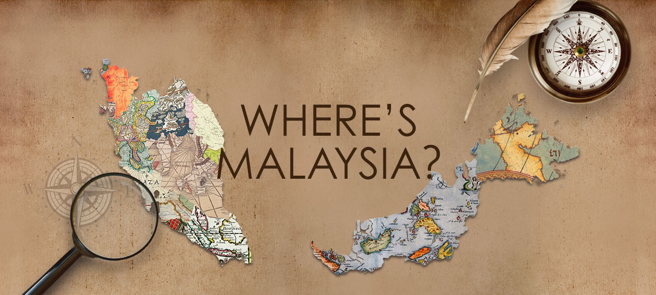
Where’s Malaysia? Exhibition

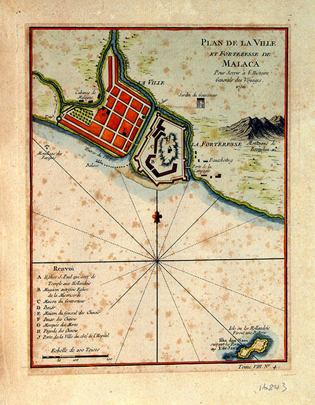
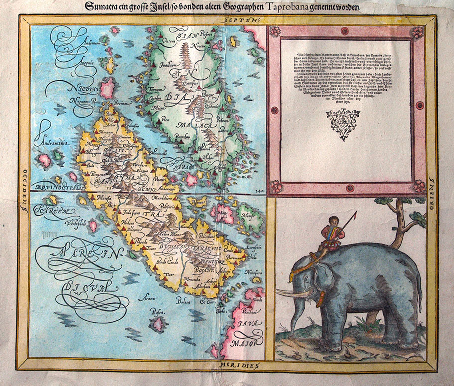
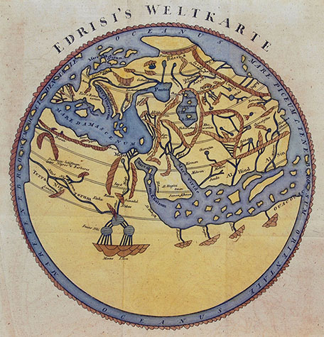
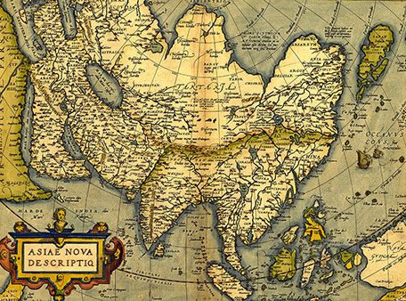
As the nation celebrates its 50th anniversary, ‘Where’s Malaysia?’ shows the changing ways of mapping the two halves of the nation, brought together in 1963. The maps in the exhibition cover a wide range, illustrating not only how the rest of the world regarded the land that would later become Malaysia, but also how Malaysia has seen itself over the past 50 years.

Just as the children’s cartoon ‘Where’s Wally?’ encourages viewers to spot the young man with the red and white stripes, this exhibition shows how difficult it can be to identify the Malay Peninsula and Borneo.

Join us to unearth Malaysia’s cartographical past and the tools that go with it.

‘Where’s Malaysia?’ exhibition
L2, Bank Negara Malaysia Museum & Art Gallery
Monday – Sunday, 10am – 6pm
Free Admission

Plan de la ville et forteresse de Malacca

France, 1750
Jacques Nicolas Bellin

Jacques Nicolas Bellin (1703 - 1772) was a French hydrographer and geographer. Bellin meticulously mapped a detailed plan of the city and fortress of Malacca, commanding the strategic straits of the same name. The legend, on the left of the map, tells the names of places marked on the city, which comprise:

  1. S.Paul Church that serves as the Dutch temple
  2. A store which was formerly used as a church
  3. Governor’s house
  4. Chinese Bazaar
  5. Mosque
  6. Chinese Pagoda
  7. City Gate on the side of the hospital

Fortresse de Malacca, better known as A Famosa, is a Portuguese fortress located in Malacca, Malaysia. It is among the oldest surviving European architectural remains in Asia. The Porta de Santiago, a small gate house, is the only remaining part of the fortress still standing. Alfonso de Albuquerque built the fortress around a natural hill near the sea. Most of the village clustered in town houses inside the fortress walls. As Malacca's population expanded it outgrew the original fort and extensions were added around 1586.

Sumatra grosse Insel so von den alten Geographen Taprobana genennet worden

Switzerland, 1588
Sebastian Munster

Taprobana was often used to refer to Ceylon (Sri Lanka) on early maps. This map focuses on Sumatra, which was also historically known as Taprobana. Based on Munster’s engraving, Sumatra was filled with scores of volcanoes. It also features the Malay Peninsula, which was known as Malacca then. Munster showed mountains in the centre of the Peninsula, which is similar to the present geographical distribution. On the right side of the map, he engraved a charming vignette of a mahout riding an elephant in what appears to be European costume.

Edrisi's Welkarte

Germany, 1780
Mohammed Al-Idrisi

A German version of Al-Idrisi's important 12th century map of the World. Mohammed Al-Idrisi (1110-1166) wrote one of the most important early travel accounts of Europe and produced one of the earliest extant world maps. Originally drawn with south at the top of the page but, for simplicity of comprehension, this version from an unidentified work has been presented in conventional form - with north at the top of the page. Providing information of England, Russia and Finmark, the map depicts the best available geographical information known to inhabitants of the Mediterranean region during the period. The horn of Africa has been extended to the Far East, becoming a close neighbour of Southeast Asia. The Malay Peninsula, Java, Sumatra and Sri Lanka have been reduced to a jumble of islands.

Asiae Nova Decriptio

Belgium, 1572
Abraham Ortelius

Another prominent work by Abraham Ortelius, this map is also featured in his Theatrum Orbis Terrarum (Theatre of the World), the world’s first modern atlas. Entitled A New Description of Asia, this map covers from Europe and Africa eastward to include all of Asia and parts of New Guinea and Australia. The cordiform projection shows Asia extended too far to the east, an error propagated by Ptolemy. Arabia is projected in an enlarged form. There are couple of interesting elements that can be noticed. Further east, in western China, Cayamay Lacus is depicted. This mythical body of water was assumed by Ortelius to be the source of the great rivers of Southeast Asia. Japan appears in a distorted projection that resembles a tadpole, while Luzon is absent from the Philippine.